Can you think of any better way to spend World Water Day than meeting with water lovers from watershed groups across New Brunswick? We couldn’t, so on March 22 we braved the weather and headed to Sussex to attend a watershed workshop!
The workshop, hosted by our friends from the Kennebecasis River Watershed Restoration Committee, was fittingly called “Staying Current”, as it provided us with the opportunity to see some of the inspiring work that is being done in watersheds across the province.
The day kicked off with introductions and it was encouraging to see many familiar and new faces, all with a common interest in New Brunswick’s watersheds. After introductions, the presentations began and focused on a variety of topics, such as current projects, social media and marketing, GIS mapping, liDAR and culvert assessments.
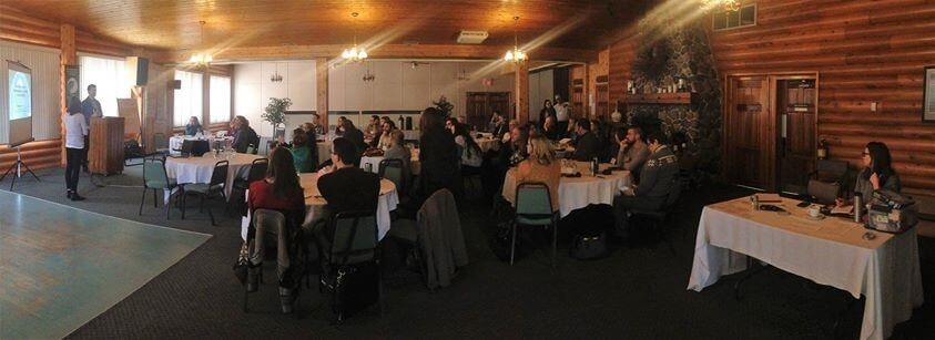 An overview of all of the attendees at the watershed workshop
(photo provided by the Nashwaak Watershed Association)
Bethany Young and Curtis Richardson gave a presentation on how they use social media to promote the work they do at the Nature Trust of New Brunswick. Social media is a powerful marketing tool and if used properly, it can really drive your organization to the next level. Just think about it, is there a day that goes by where you or the people around you are not connected to some form of social media? Whether your organization is large or small, we learned that it is important that you have a social media “personality” that is consistent with your organization’s message. There are many tools available to help you develop your social media profile, such as Salesforce, a customer relationship management product that allows you to effectively communicate with the public. There really is no better way to instantly send out information to the public on what is going on in your watershed and we think that everyone was able to take away some helpful tips from this presentation!
Another useful tool that we are seeing more often in watershed work is Geographic Information Systems (GIS) and particularly Esri Story Maps. Dr. Wendy Monk is a Research Associate with the Canadian Rivers Institute (CRI) and she showed us how they have used story maps to display their work. The Esri program lets you combine data, images, text, maps, etc. to tell a story that is specific to your watershed and they can be as detailed or as simple as you want! If your organization is a registered charity, you may be eligible for a discount on this creative tool. We were really impressed with how the CRI has used this tool to tell their stories and we can’t wait to play around with it to tell ours!
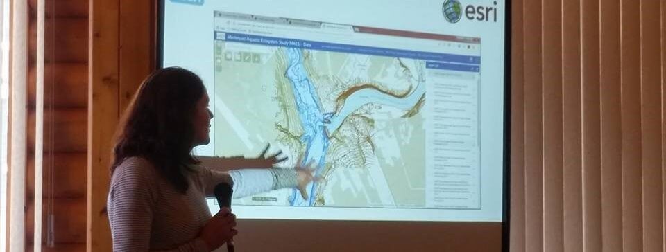 Dr. Wendy Monk showing us the CRI’s story map
(photo provided by the Canadian Rivers Institute)
The Esri program lets you combine data, images, text, maps, etc. to tell a story that is specific to your watershed and they can be as detailed or as simple as you want! If your organization is a registered charity, you may be eligible for a discount on this creative tool. We were really impressed with how the CRI has used this tool to tell their stories and we can’t wait to play around with it to tell ours!
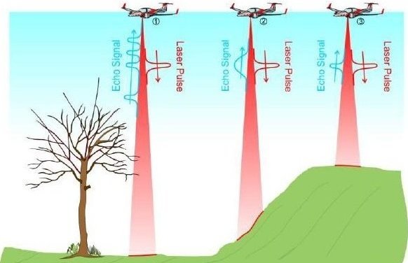
Have you heard of LiDAR but you weren’t quite sure what is was? Adam Dick from the Department of Energy and Resource Development gave an informative presentation on how they are using LiDAR in New Brunswick, and it is safe to say that we learned a lot! LiDAR stands for Light Detection and Ranging and it is a remote sensing method used to look at the surface of the earth. Airborne LiDAR works by pulsing a laser from an airborne structure (like a plane or drone) towards the earth and when it touches the ground, the pulse is reflected back. The result is a 3D model of the landscape that is very accurate. Talk about high tech! Currently, 58% of New Brunswick is mapped with LiDAR and all the data is available online at the GeoNB Data Catalogue . The data from LiDAR is used in many fields, including agriculture, geology, physics, mining, forestry and of course watershed work. We really enjoyed this presentation and I think it’s safe to say that others did too as Adam answered a lot of questions!
Airborn LiDAR
At the end of the presentations, everyone discussed what they thought the goals for the working group on watershed management should be. There were lots of great ideas that included having a better communication strategy, as well as better access to data. For the full list of recommendations, we will link to the NBEN report when it becomes available.
Thanks to the Kennebecasis River Watershed Restoration Committee, as well as the planning committee and of course the New Brunswick Environmental Network for putting together a great workshop. We had a wonderful World Water Day and can’t wait to implement all the things we learned, as we continue to work on freshwater protection in New Brunswick!
-30-
For more information on freshwater conservation in New Brunswick:
- Download our water-themed EcoAlert Spring 2017 for a complete map of NB Watersheds and more!
- Read all about Water Classification New Brunswick’s Water Classification Strategy, here.